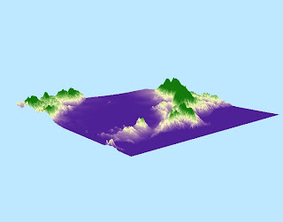
This is a DEM of the southern half of the San Francisco Bay Area from (-122.566, 37.313) to (-121.963, 37.783). This is where I grew up, which is why I wanted to explore its topography. I used to hike through the Santa Cruz mountains a lot when I was younger, looking for reptiles and amphibians and they remain my favorite mountain range. I have lots of amazing memories hiking and camping in these mountains with my family and friends. The GCS used is the North American 1983 and the datum used is the North America 1983.
Shaded Relief Model
Slope Map

Aspect Map

3D Image of Area

No comments:
Post a Comment